
A VIEW FROM ABOVE
Michigan Drone Photography Service
As a certified FAA Part 107 Remote Pilot, I can offer you high-resolution aerial photography and mapping services for various projects in Southeast Michigan. Serving the Metro-Detroit area for photogrammetry, orthomosaic mapping projects, inspection, environmental surveys, construction progress, stockpile measurements, and virtually anything that could use a bird’s eye view and experienced drone pilot. As a Master Naturalist, citizen scientist, and engineer – I offer a wide range of expertise and passions to support your project.
586.215.2512
images @ grafphoto.com

This aerial view of the Anna Scripps Whitcom Conservatory on Detroit’s Belle Isle was licensed by National Geographic for a piece on the most beautiful urban parks.
About Graf Photography Aerial Photo Services
Use of small UAVs (drones) for any type of commercial photography application, even if only for a support function for your business (like a farmer inspecting a field) requires remote pilot licensing through the FAA. This requires a significant time investment in studying for the remote pilot exam, which requires renewal every 2 years under current regulation. While many companies requiring frequent drone work often train in-house employees to satisfy this business need, it simply doesn’t make sense for small firms requiring occasional work to make this commitment in capital and resources.
This is where I can help you.
Serving Southeast Michigan, Metro-Detroit area aerial photography projects since 2018.

Michigan Aerial Photos
From aerial building survey inspections to photographs to video, I can provide you with drone services tailored to your project needs around the Metro=Detroit area.

Orthomosaic Maps
Orthophotos (or orthomosaic maps / orthoimagery) are highly detailed, scalable assemblies of overlapping images that are used for inspections, surveys, and aerial imagery products.

Real Estate & Construction
Aerial photos and videos of real estate developments are in high demand. Use for sales to documentation of storm damage and insurance claims. Drone surveys for construction site monitoring and progress.

Ecological Services
With minimal disturbance, get an aerial view of sensitive habitats, wetlands, forested areas, and water bodies. Aerial views for environmental mapping and monitoring, tree surveys, big tree documentation, and more.
Benefits of Orthomosaic Photos (Orthophotos, Orthomosaics)
Orthomosaic maps are created from customized flight plans where the drone takes dozens, even hundreds, of photographs pointing straight down (nadir view) over a specified area. These offer the following benefits over a satellite image:
- Much finer detail and resolution over Google Maps (up to 20X more detail)
- Higher resolution over a single drone photo, which may be altitude limited for large areas
- Perspective correction – a true “straight down” view vs. having sides of buildings and other optical distortions from a single photograph.
- DEM (a digital elevation map) capability with color gradients to represent elevations of objects
- Real-time monitoring of projects or monitoring changes over time with a repeatable flight plan
- Fine detail for inspections and environmental monitoring around Michigan and the Detroit area; such as solar installations, roofs, parking lots, construction sites, ArcGIS map assets, garden beds, legal purposes and more!

COMMUNICATION • PLANNING • EXECUTION • DELIVER

Prairie Fen at Davis Lake AR10189
ENVIRONMENTAL
Ecologically Sensitive Nature Preserves
Aerial photo surveys offer a low-impact method of inspecting natural assets and ecological restoration sites. From wetlands to prairie fens to dense forests, having aerial documentation of habitats plays a key role in effectively planning mitigation efforts and developing risk assessments for our most sensitive natural spaces and the biodiversity within them. Create orthomosaic maps for stunning detail and accuracy to monitor changes over time.
Energy and Infrastructure
Michigan Renewable Energy
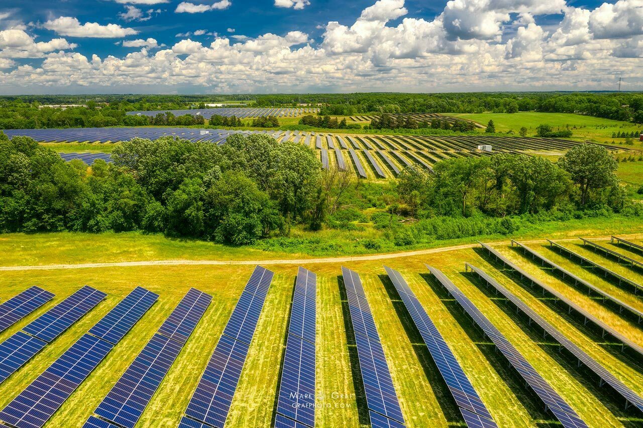
Infrastructure investments in solar plants and other renewable energy projects are on the rise in Michigan. Successfully promoting these projects requires visually engaging photography. Maintenance and project management of these investments can utilize the detailed mapping abilities of a drone. Licensing existing work and scheduling flights for new projects are a simple email away.

MUNICIPLE GREEN INFRASTRUCTURE PROJECTS
Aerial Views of City Parks and Green Spaces
Aerial photos offer an excellent option to document progress, completion and promotion of green infrastructure and sustainability projects. These projects are increasing in importance for placemaking, creating desirable places to live, and mitigating risks from climate change.
Environmental Photojournalism
Legal Documentation and Stories
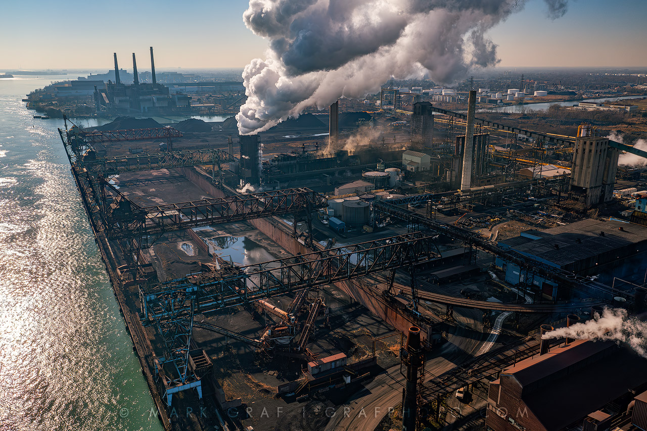
Some humans do not have stellar reputations regarding land use and the environment. We cannot just view the world through rose-tinted glasses of beautiful photos. Aerial documentation can help hold violators of environmental laws accountable.
Get your aerial perspective today!
Contact me to discuss any project ideas – I look forward to working with you.
[email protected]
(586) 215.2512